GA 1652-4 – Point Cloates Cheap
Description
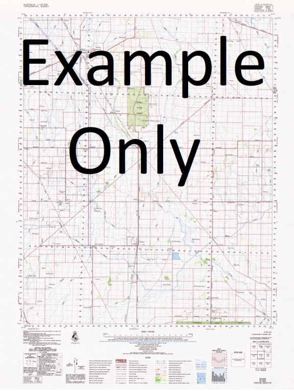
This Topographic Map is produced by Geoscience Australia; Australia s national geospatial organisation.
GA topographic maps (many of which are produced in partnership with the Army) are generally older than those maps produced by the State Governments over the same area. This makes GA maps particularly useful for identifying historic features, such as old mines and diggings.
Geoscience Australia maps generally considered to be more pleasing in design and compilation then the more modern State Government productions.
At this scale, 2cm on this map represents 1km on the ground. A standard map (which is square) covers an area of approximately about 25km by 25km, with a contour interval of 10m. This map contains natural and constructed features including road and rail infrastructure, vegetation, hydrography, contours, localities and some administrative boundaries.
Please note the date of the map, as this will impact the currency of information, particularly regarding infrastructure, roads, etc.
Apex Hill Beacon Point Cloates Hill Frazer Island House Well Jane Bay Jarvis Well Javis Well Kadjilikundi Well Lefroy Bay Ningaloo Ningaloo Marine Park North Bore Norwegian Bay Perth Hill Point Billie Point Cloates Point Cloates Light Point Cloates Lighthouse Point Edgar S.S. Perth Sextant Hill Shed Well Weajuggoo Hill Wilson Well Wealjugoo Hill Weaguggu Hill Fraser Island Frazer Islet Entrance Hill Black Rock
Additional Information
| Title | Paper, Laminated |
|---|
Related products


linkrelayus.shop © 2025 All Rights Reserved