QLD 7370 Online now
Description
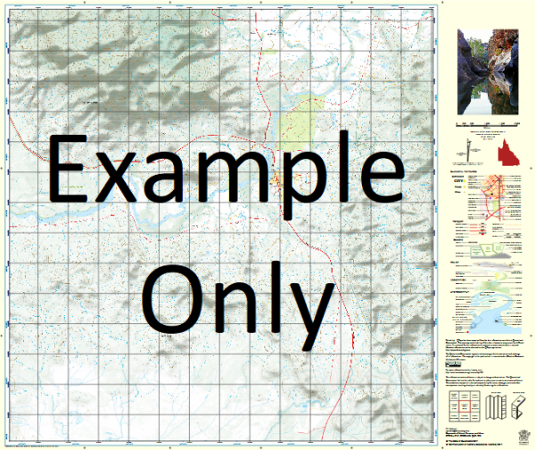
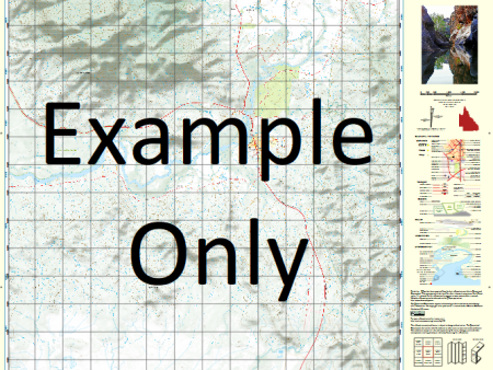
This Topographic Map is produced by the Department of Natural Resources and Mines (DNRM), part of the Queensland Government.
This product is continously updated with the latest information available. New editions are generally published in Oct Nov each year, however minor updates are constantly being included.
DNRM maps are produced automatically by computers, with minimal human oversight; so some duplication of information and occasional minor cartographic inconsistencies can be found.
The PDF version of this can be printed at home or sent to a professional printer for a 100% scale reproduction.
At this scale, 1cm on this map represents 1km on the ground. A standard map (which is square) covers an area of approximately 54km by 54km, with a contour interval of 20m. This map contains natural and constructed features including road and rail infrastructure, vegetation, hydrography, contours, localities and some administrative boundaries.
Lake Archer Coen River Glenesk Gormanston Johnny Camp Creek Kenyon Kinlock Creek Logwater Creek Merapah Merapah Lagoon Middle Creek Mistake Creek Monsell Mountain View Creek Nookanon Creek Ormonde Rathmore Rayleigh Running Creek Spring Creek Tent Pole Hut Tentpole Creek The Spring Toby Creek Tufton Whistlers Lagoon Williams Creek Mary Creek Merapah Creek Drumtop Creek Cooper Creek Micks Lagoon The Spring Creek Kinloch Creek Kendale River Middle Camp Yard Trough Lagoon
Additional Information
| Title | Paper, Laminated, Pdf Download |
|---|
Related products


Information
Customer Care
Other Business
Newsletter

linkrelayus.shop © 2025 All Rights Reserved